GEOGRAPHY
What is our aim with Geography at Springfield?
At Springfield Junior School, our goal is to ignite pupils' curiosity and fascination for the world around them. We encourage children to explore and understand the Earth's physical processes and the geographical knowledge that highlights how our planet's features are interconnected and have evolved over time. Through active and engaging lessons, pupils will develop vital life-skills while cultivating a deeper appreciation for their environment and the diverse cultures that shape our world.
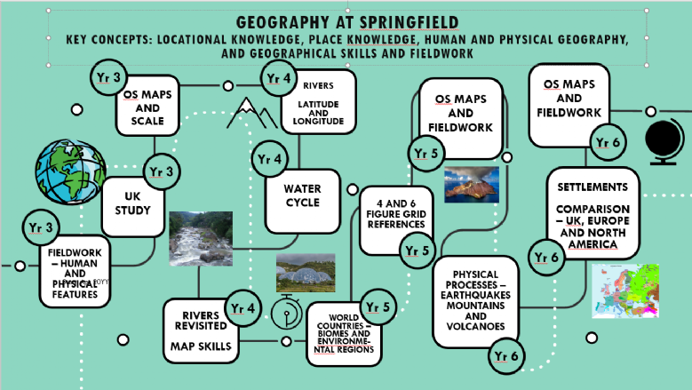
By the end of Year 6, our aim is for children to have a strong understanding of their place in the world and to celebrate their family heritage by having a broader awareness of how their local area fits into the larger context of the country, continent, and world. We view this learning journey as a jigsaw puzzle, where children piece together the knowledge they have accumulated over time, enhancing their grasp of disciplinary knowledge (thinking like a Geographer). For instance, pupils study continents like Europe and explore how the UK fits within this broader context.


What does this look like in our classrooms? (Implementation)
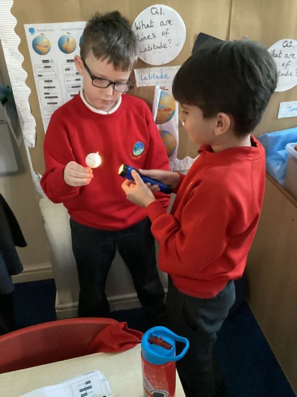
In our classrooms, geography comes alive through active learning experiences and engaging activities. Each module begins with a captivating 'hook' activity that sparks curiosity and prepares pupils for the new concepts they will explore. We enhance learning with trips to local areas, allowing pupils to apply the skills they are taught in geography lessons. During these trips, the children use geographical skills such as first-hand observation, map reading, and compass navigation to explore their environment, making real-world connections to their classroom learning.
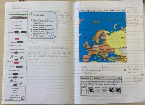
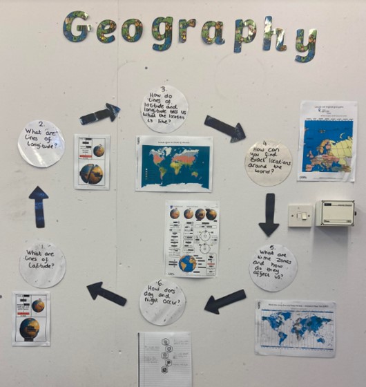
Our geography curriculum isn't just about learning in the moment. We help our children remember what they've learnt by using retrieval and spaced retrieval practice, while using activities that encourage practice and opportunities to apply their knowledge through 'Thinking Hard' tasks. This approach helps them connect new knowledge to what they already know, making it easier to understand and remember. Concepts and vocabulary are explicitly taught in context and built upon through each unit of work across the school.
This is made up of:
*Substantive knowledge (the big ideas in Geography) which are Human and Physical Geography, Locational Knowledge, Place Knowledge and Geographical Skills and Fieldwork.
*Disciplinary knowledge (working like a Geographer) which are Place and Space, Scale and Connection, Physical and Human Geography, Environment and Sustainability, Geographical Enquiry, Culture and Diversity
At Springfield Junior School, our geography lessons are designed to be engaging, inclusive, and thought-provoking. Here’s how we meet these goals:
-Promoting Pupil Voice: We encourage children to actively share their ideas, ask questions, and participate in discussions about the topics they are studying. This builds their confidence and critical thinking skills, helping them develop a deeper understanding of geographical concepts.
-Displaying Learning on Our 'Loops of Learning' Wall: In each classroom, we showcase key skills, vocabulary, and important learning outcomes on our 'Loops of Learning' wall. This helps reinforce learning and allows children to see their progress while revisiting key concepts throughout the year. Ancillary questions help guide their learning, promoting curiosity and independent thinking.
-Providing a Diverse and Creative Curriculum: Our geography curriculum is rich and varied, including hands-on activities, map work, field trips, and the use of technology to explore the world. We ensure that students engage with different cultures, environments, and physical processes, making their learning both exciting and relevant.
-Building Aspiration Through Wider Experiences: We create opportunities for children to extend their learning beyond the classroom with visits to local areas and geographical trips. These experiences allow pupils to apply their skills, such as map reading, using compasses, and observing physical and human features in the real world, inspiring a deeper connection to their studies and raising aspirations.

How do we support and assess all learners?
In line with all other areas of the curriculum, within geography we strive to meet the needs of all pupils and ensure they have the right to progress and meet their potential. We measure the success of our curriculum by assessing how well the children have met the intended outcomes through formative assessment and through structured pupil book studies, sitting alongside the children and asking them about their learning. We track their progress using an assessment system called Insight to analyse and address any gaps in the children’s learning and to inform regular curriculum reviews and action plans.
The impact of our Geography curriculum is that:
- children understand how our human footprint has an impact on the world
- children understand that the world they live in has not always been this way
- children think like geographers and have curiosity and fascination about the world they live in
- children's horizons are broadened, opening doors to parts of the world they haven't seen or experienced yet